Temps to stay above normal next week but more rain could be on the way

(TULSA, Okla.) Scattered showers and thunderstorms will dissipate by around sunset Sunday. Another round of showers and storms is expected late Monday morning through the afternoon, but widespread significant rainfall is not expected.
After Monday, the rest of the week looks dry as an upper ridge builds over the area. There is a signal in some of the model data that a southward moving complex of thunderstorms may evolve Tuesday into Tuesday night and affect at least northern parts of the forecast area, but we have kept the forecast dry for now in line with the National Blend of Models.
This potential will continue to be evaluated over the next day or two. Temperatures will be well above normal from the middle of the week through next weekend, but it appears dew points will be low enough to preclude any heat headlines.
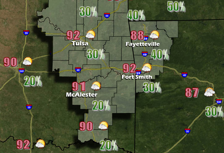
Monday
A 30 percent chance of showers and thunderstorms, mainly after 1pm. Partly sunny, with a high near 92. Heat index values as high as 100. Calm wind becoming east around 5 mph in the afternoon.
Monday Night
Partly cloudy, with a low around 72. East wind around 5 mph becoming calm in the evening.
Tuesday
Sunny, with a high near 93. Calm wind becoming east around 5 mph in the afternoon.
Tuesday Night
Mostly clear, with a low around 72. East wind around 5 mph becoming calm in the evening.
Wednesday
Sunny, with a high near 95. Calm wind becoming east around 5 mph in the morning.
Wednesday Night
Mostly clear, with a low around 71. East wind around 5 mph.
Thursday
Sunny, with a high near 95. Southeast wind 5 to 10 mph.
Thursday Night
Mostly clear, with a low around 69. Southeast wind 5 to 10 mph.
Friday
Sunny, with a high near 95. South wind 5 to 10 mph.
Friday Night
Mostly clear, with a low around 69. South wind 5 to 10 mph.
Saturday
Sunny, with a high near 95. South wind 5 to 10 mph.
Comments
This story has no comments yet