Weather across America

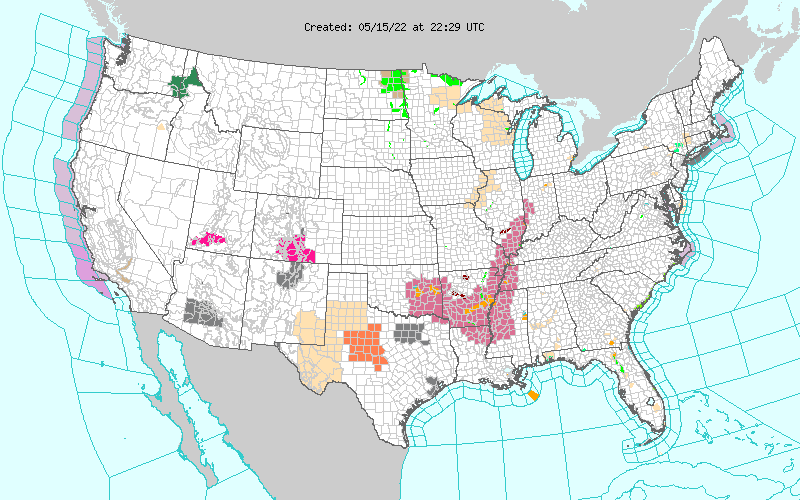
(NATIONAL) Severe weather and flash flooding potential across the Lower Mississippi/Ohio Valley, next system to eject into the Great Plains to produce another potential round of severe weather, and summer-like and record breaking heat to persist across the Southwest and southern Plains.
Spring has kicked into full gear across the country, with daily chances for severe thunderstorms and flash flooding as well as widespread summer-like temperatures.
A cold front progressing across the Ohio Valley and into the southern Plains will trigger a continuing severe weather threat into Monday. Thunderstorms will be capable of producing damaging wind gusts, large hail, and tornadoes from eastern Oklahoma to northern Arkansas and southern Missouri.
Torrential rain may also accompany the storms and lead to isolated instances of flash flooding. A few thunderstorms could turn severe farther east into the Ohio Valley as well.
By Monday, a rapidly strengthening low pressure system along the aforementioned cold front will swing eastward and eventually into the Interior Northeast. As it does so, a line of potentially severe thunderstorms is expected to develop ahead of the approaching cold front and impact parts of the Northeast and Mid-Atlantic.
Damaging wind gusts and isolated tornadoes are the main concern, with large hail also possible. The Storm Prediction Center has issued an Enhanced Risk (level 3/5) of severe thunderstorms from Upstate New York to northern Virginia. Additionally, flash flooding may accompany any slow-moving thunderstorms for this region, with a slightly more elevated heavy rain threat located in northern New York and Vermont, where a Slight Risk (level 2/4) for excessive rainfall has been issued.
The strong spring cold front will exit into the western Atlantic by Monday night, ushering in comfortable temperatures and increasingly tranquil conditions for the region on Tuesday.
The next system to impact the central U.S. will eject into the Great Plains by Tuesday. Areas of low pressure forming in the lee of the Rockies will slowly push eastward and interact with a nearby stationary front to focus showers and thunderstorms across the central Plains. The SPC has issued an Slight Risk (level 2/5) of severe thunderstorms across southern Nebraska, northern Kansas, and into parts of Iowa and Missouri. Torrential downpours and isolated chances for flash flooding may also accompany the storms.
Elsewhere, unsettled weather located across the Northwest could spawn scattered severe thunderstorms throughout the Interior Pacific Northwest into Monday. Terrain susceptible to rapid runoff will also be under the risk of flash flooding, which has prompted Flood Watches to be issued.
For the Southeast and Deep South, a warm and muggy air mass ahead of the approaching cold front will produce an environment conducive for scattered showers and thunderstorms over the next few days, with most storms remaining unorganized and short-lived. However, an isolated severe storm or two cannot be ruled out.
Outside of the Northwest, Great Lakes, and Upper Midwest, above average temperatures will be widespread over the next few days and could reach into record territory for portions of the southern tier. Highs into the upper 90s and triple digits are forecast across the Desert Southwest and southern Plains through Tuesday. Particularly for the Lone Star State, highs nearly 20 degrees above average on Tuesday will have the potential to break several daily high temperature records.
The continuing early-season heat can be dangerous is proper heat safety is not followed. Residents are urged to stay hydrated and avoid strenuous outdoor activities during peak heating hours.
Comments
This story has no comments yet