Weather across America

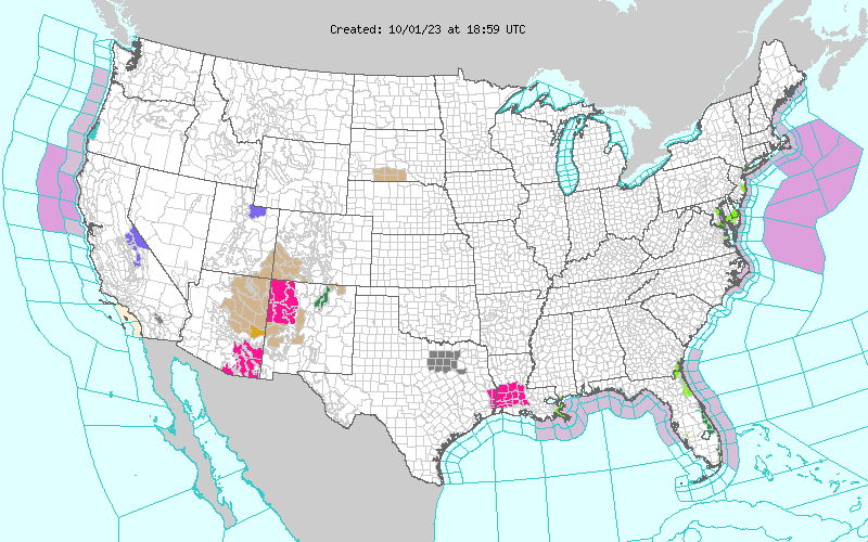
(NATIONAL) A Slight Risk of excessive rainfall over parts of the east coast of Florida and over the Southern High Plains, a Slight Risk of severe thunderstorms over parts of the Southern High Plains, and heavy snow over parts of the higher elevations of northeastern Utah.
On Sunday, tropical moisture and a lingering front over Florida produced showers and thunderstorms with heavy rain. The WPC issued a Slight Risk of excessive rainfall over parts of the east coast of Florida through Monday morning. The associated heavy rain will create mainly localized areas of flash flooding, with urban areas, roads, and small streams the most vulnerable. The threat of excessive rainfall decreases on Monday over Florida.
Showers and thunderstorms will develop over parts of Florida through Tuesday morning.
Meanwhile, an upper-level low over parts of the Great Basin and California will begin to weaken on Monday as the trough moves eastward to the Rockies. Rain and, in some places, higher elevation snow will develop over parts of the Great Basin into the Northern Intermountain Region and California/the Great Basin through late Monday morning.
Parts of northeastern Utah will get heavy snow at higher elevations through Monday evening.
The upper-level troughing will allow temperatures to be 10 to 20 degrees below average over parts of California, the Great Basin, the Northern Intermountain Region, and the Northern Rockies. Furthermore, upper-level ridging extending from the Gulf Coast to the Upper Great Lakes will allow temperatures to be 15 to 25 degrees above normal over parts of the Upper Midwest.
An area of rain will move northward into the Northern Rockies/Northern High Plains on Monday into Tuesday. Also, a weak front will move over the Pacific Northwest and dissipate by Tuesday, creating rain over parts of the Pacific Northwest on Monday. The front associated with the deep upper-level trough will move across the Southern Rockies and Southern High Plains on Monday, producing showers and severe thunderstorms over eastern New Mexico and western Texas.
Therefore, the SPC has issued a Slight Risk of severe thunderstorms over parts of the Southern High Plains from Monday into Tuesday morning. The hazards associated with these thunderstorms are frequent lightning, severe thunderstorm wind gusts, hail, and a few tornadoes. Additionally, showers and thunderstorms will develop over parts of the Northern/Central Plains overnight Monday into Tuesday morning.
Lastly, onshore flow off the Western Gulf of Mexico will aid in producing showers and thunderstorms over parts of the Western Gulf Coast through Tuesday.
Comments
This story has no comments yet