Weather across America

(NATIONAL) Heavy rain from the remnants of Philippe comes to an end across Maine but flooding and gusty remain, below average temperatures for much of the Great Lakes and eastern U.S. along with lake effect rain showers and thunderstorms, colder and wetter weather on the West Coast, and above average warmth for the Interior West and Rockies.
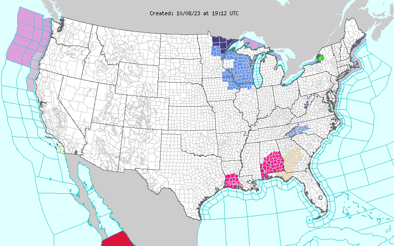
A swath of heavy rain over Maine early Sunday morning, tied to what was formerly Tropical Storm Philippe, moved into the Canadian Maritimes, leaving behind areas of flooding from roughly three to five inches of rain which impacted the region. Gusty winds remained Sunday, especially over northern Maine, but these too should begin to subside.
Cool, fall-like temperatures will remain over the Great Lakes and east of the Mississippi River over the next couple of days, as a large closed low in the upper levels of the atmosphere remains situated over southeastern Canada, just north of the Great Lakes. High temperatures were 10 to 20 degrees below average from the Great Lakes to the Mid-Atlantic and Southeast Sunday, with some moderation of temperatures on Monday but remaining below average. Cold air passing over the relatively warm waters of Great Lakes, lake effect showers and thunderstorms will be common for locations downwind (south and east).
A favorable wind fetch across Lake Ontario will support persistent and heavy rain at times for areas immediately southeast and east of the lake, allowing for one to three inches (locally higher) which may result in localized areas of flooding Sunday night.
With the exception of isolated, diurnally driven thunderstorms for central Arizona into New Mexico, warm and dry conditions will continue for the central and western U.S. High temperatures were 10 to 20 degrees above average for most everyone west of the High Plains Sunday, but the arrival of a Pacific cold front will bring colder temperatures and rain for locations extending from northern California to western Washington starting Monday morning.
Cooler temperatures will spread from west to east into the Great Basin behind a cold front for Monday into Tuesday but warm weather with highs in the mid-70s to mid-80s will remain for locations just east of the Continental Divide into the Central Plains.
Comments
This story has no comments yet