Weather across America

(NATIONAL) Moderate to heavy rain possible across parts of the Northeast, heavy lake-effect snowfall downwind of the Great Lakes, and below average temperatures common for much of the country.
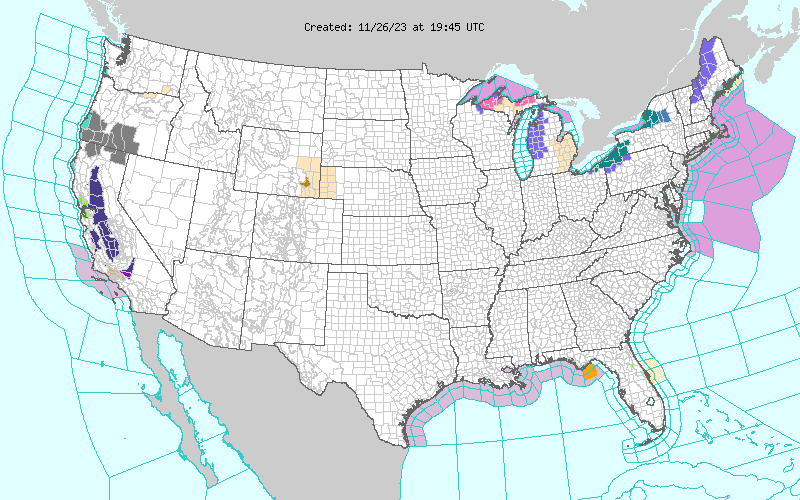
Low pressure tracking up the east coast Sunday night and cold air surging into the eastern half of the nation by early this week will set the stage for unsettled and impactful weather for parts of the country. Moderate to locally heavy rain is likely to swing northward from the northern Mid-Atlantic coastline to southern New England Sunday night, with snowfall possible in the elevated terrain of northern New England. This wave of precipitation will continue pushing northward on Monday throughout Maine.
Winter Weather Advisories have been issued from northern New Hampshire to northern Maine, where up to 6 inches of snowfall is possible. Additionally, a separate area of precipitation dampening northern Florida Sunday afternoon is expected to exit the region Sunday night and lead to mostly dry conditions across the Sunshine State on Monday. As cold air rushes into the eastern U.S. over the next few days, favorable westerly winds and warm lake temperatures will allow for heavy lake effect snowbands downwind of the Great Lakes.
The highest snowfall totals are likely downwind of lakes Erie and Ontario. Snow accumulations upwards of 15 to 20 inches are possible where Lake Effect Snow Warnings have been issued. Lake effect snow is also possible downwind of Lake Michigan and Lake Superior, with up to a foot of snow possible across the U.P. of Michigan.
Residents and visitors traveling within the Great Lakes region are advised to remain weather aware and prepare for drastically changing road conditions depending on the location of snow showers and heavy snowbands. Elsewhere, dry and cool weather is anticipated throughout the rest of the CONUS as high pressure dominates. Showers may begin to enter parts of central California on Wednesday as a low pressure system nears the West Coast.
Below average temperatures will stretch across much of the country on Monday and confine to the eastern U.S. on Tuesday. Lows into the single digits and teens are forecast for the central/northern Plains and Upper Midwest on Monday, with blustery and winter-like temperatures found throughout the Ohio Valley, Mid-Atlantic, and Northeast on Tuesday.
Comments
This story has no comments yet